Description
Files Included
Reviews
Unreal Engine – Landscaping provides seamless integration of GIS data into Unreal Engine workflows, enabling the import of Digital Terrain Models (DTM) in formats like GeoTiff, ASCII, HGT, and GeoPackage. It supports a wide range of projections, handling resolutions accurately while processing single or multiple files. Users can easily import satellite imagery such as material textures, decals, or vertex colors, with automatic mapping to landscapes or meshed.
The tool generates Weightmaps and auto-paints Landscape paint layers while supporting Spline creation from Shapefiles and other vector data formats like GeoJSON, OSM, and GeoPackage. Advanced features include merging, cropping, smoothing, and adjusting scale, offering robust tools for handling terrain of any size or area. The addition of Blueprints simplifies workflows, removing the need for external tools like QGIS.
You can see the downloadable file list by clicking Landscaping UE Download.
Pre-Download Product File Details: Everything You Need to Know
The size of “Unreal Engine (Landscaping).rar”, after extraction, is (597.6 MB) And Includes:
- File Type “.uplugin” : Count(1) – Size (977.0 bytes)
- File Type “.dll” : Count(130) – Size (210.2 MB)
- File Type “.pdb” : Count(2) – Size (159.4 MB)
- File Type “.modules” : Count(1) – Size (182.0 bytes)
- File Type “.xml” : Count(12) – Size (476.6 KB)
- File Type “.wkt” : Count(8) – Size (1.4 MB)
- File Type “.rsc” : Count(2) – Size (905.5 KB)
- File Type “.json” : Count(25) – Size (345.4 KB)
- File Type “.png” : Count(4) – Size (36.4 KB)
- File Type “.svg” : Count(6) – Size (74.3 KB)
- File Type “.xsd” : Count(14) – Size (310.1 KB)
- File Type “.csv” : Count(144) – Size (1.3 MB)
- File Type “.dxf” : Count(4) – Size (20.3 KB)
- File Type “.gfs” : Count(70) – Size (432.3 KB)
- File Type “.ini” : Count(5) – Size (14.0 KB)
- File Type “.txt” : Count(4) – Size (75.4 KB)
- File Type “.dgn” : Count(4) – Size (22.0 KB)
- File Type “.mapml” : Count(2) – Size (3.9 KB)
- Without File Type : Count(45) – Size (3.0 MB)
- File Type “.extra” : Count(7) – Size (170.9 KB)
- File Type “.lst” : Count(5) – Size (31.9 KB)
- File Type “.gsb” : Count(4) – Size (1.1 MB)
- File Type “.dat” : Count(4) – Size (2.1 MB)
- File Type “.db” : Count(3) – Size (23.7 MB)
- File Type “.uasset” : Count(21) – Size (22.6 MB)
- File Type “.cpp” : Count(48) – Size (987.9 KB)
- File Type “.h” : Count(1105) – Size (12.5 MB)
- File Type “.lib” : Count(90) – Size (155.8 MB)
- File Type “.cs” : Count(2) – Size (10.8 KB)
- File Type “.inc” : Count(13) – Size (113.0 KB)
- File Type “.proto” : Count(12) – Size (98.7 KB)
- File Type “.exe” : Count(9) – Size (459.0 KB)
you can see a detailed list of all files extracted from the product packages, including their names, sizes, and types from the “Files Included” tab above.
Landscaping for Unreal Engine Overview
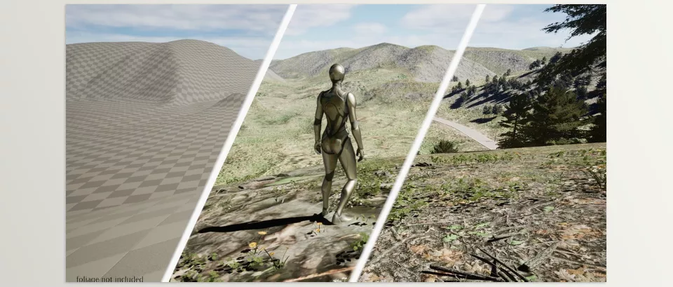
Image 1: Unreal Engine – Landscaping Accurate Representation

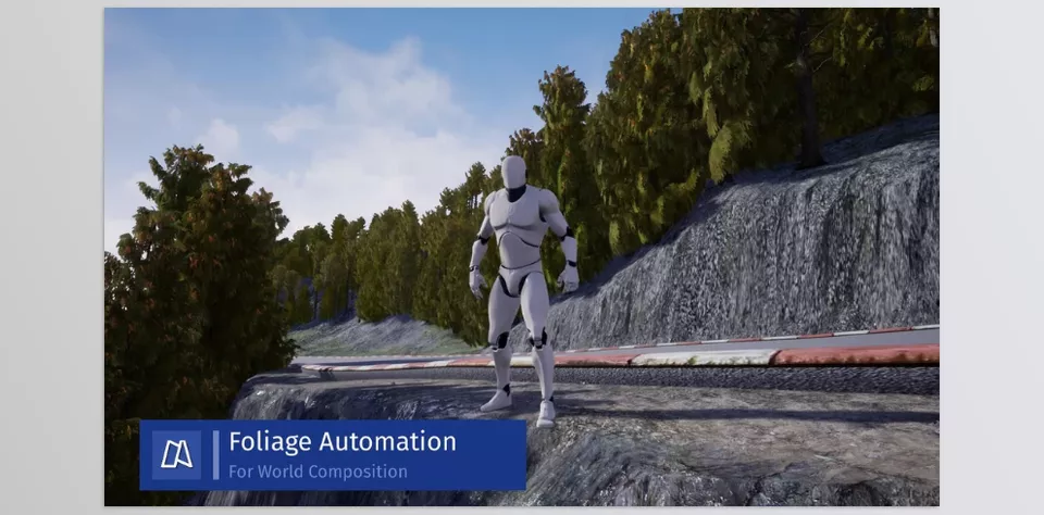
Image 2: Unreal Engine – Landscaping Handles landscapes of any size

Ludic Drive – Landscaping Features
- Versatile Data Import: Supports a wide range of file formats for terrain, satellite imagery, and vector data.
- Accurate Representation: Handles various projections and resolutions to ensure accurate integration.
- Seamless Integration: Automatically tiles and merges multiple DTMs for seamless landscapes.
- Enhanced Detail: Smooths low-resolution DTMs and imports at different scales for desired detail.
- Scalability: Handles landscapes of any size, limited only by system memory.
- Organized Editing: Provides up to 16 x 16 km edit layers per landscape for efficient management.
- Multiple Landscapes: Allows for multiple seamless landscapes within a level.
- Diverse Output Options: Imports DTMs as either Landscapes or Meshes, and satellite imagery as textures, decals, or vertex colors.
List of all files available for Landscaping after extraction
You will find a detailed inventory of all files extracted from our product packages here. Users can click on folders to navigate sub-folders and files, ensuring an organized and intuitive browsing experience. This comprehensive list includes the file names, sizes, and types, providing a clear and organized view of the extracted content. Whether you need to locate specific documents, installation files, or media assets, this page offers an efficient way to manage and access the various components of your product package. Use this resource to streamline your workflow and ensure you have all the necessary files at your fingertips.

Click the above button to show the file list
{{ reviewsTotal }}{{ options.labels.singularReviewCountLabel }}
{{ reviewsTotal }}{{ options.labels.pluralReviewCountLabel }}
{{ options.labels.newReviewButton }}
{{ userData.canReview.message }}
How to get Geo Data
Last Update
December 7, 2024
Published
December 7, 2024
Categories
Visits
173
Home Page
Unreal Engine Versions
4.25-4.27, 5.0-5.5
Tags:


